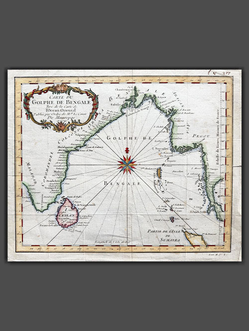
Carte de Golphe de Bengale
Original engraved plan by Jacques Nicholas Bellin (1703-1772)
This exquisite map by Jacques-Nicolas Bellin illustrates the Bay of Bengal during the height of French influence in India. Published in 1740, the map showcases coastal cities, islands, and regions of strategic and economic importance during a period when France nearly rivaled Britain as the dominant European power on the subcontinent.
The map highlights key coastal cities along the Bay of Bengal, including Pondicherry (Pondicheri) marked with a star, the capital of French India, which was central to French administration and trade. While overshadowed by British dominance, France’s influence in India was notable, with territories like Pondicherry, Yanam, Mahe, and Karikal. French ambitions, driven by competition with Britain, escalated in the mid-18th century under Joseph François Dupleix, leading to conflicts like the War of the Austrian Succession and the Seven Years’ War. Though the British defeated the French at the Battle of Plassey in 1757, France retained control of its coastal territories until India’s independence in 1947 and the formal transfer in 1962.
This map was meticulously crafted by Jacques-Nicolas Bellin and published as plate No. 1 in Volume 2 of the 1740 edition of Abbé Prévost’s L’Histoire Générale des Voyages. Bellin’s work, renowned for its precision and detail, is preserved in several libraries across Europe and North America, either as an individual map or as part of Prévost’s celebrated publication.
Image Size (cms): 23.5(H) x 28.5(W)
Image Size (inches): 9.5(H) x 11(W)

