East Indies
Original engraved map by A Dury (1766-1777)
Size (cms): 14.5(H) x 12.5(W)
Size (inches): 5.5(H) x 5(W)

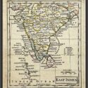
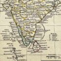
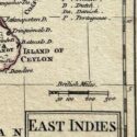
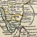
Original engraved map by A Dury (1766-1777)
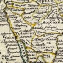
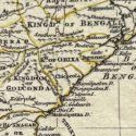
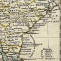
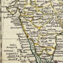
This original, rare map of India, engraved by A. Dury (fl. 1766–1777), was published in 1761 as part of the A New General and Universal Atlas.
Dury was a British map and print publisher based in Duke’s Court on St. Martin’s Lane in London. Although he was a skilled mapmaker, he achieved less success than his contemporaries, such as Thomas Jefferys and William Faden, making his maps relatively rare. Dury is most commonly associated with the large Indian maps by James Rennell, one of his key collaborations. In addition, he produced notable maps during the Revolutionary War, including plans of Boston and Philadelphia, as well as a series related to the Russo-Turkish War of 1768–74. Despite his limited commercial success, Dury’s works remain valuable for their historical and cartographic significance.
Size (cms): 14.5(H) x 12.5(W)
Size (inches): 5.5(H) x 5(W)