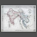
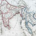
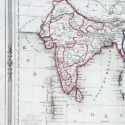
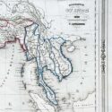
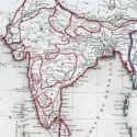
Hindoustan ou Inde
Original engraved map by V. Levasseur ( 1800-1870)
Size (cms): 24.5(H) x 32.5(W)
Size (inches):9.5(H) x 13(W)

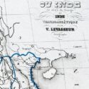
Original engraved map by V. Levasseur ( 1800-1870)
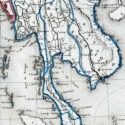
Victor Levasseur’s 1848 map of India and Southeast Asia, created for Maison Basset’s Atlas Illustré destiné à l’enseignement de la géographie élémentaire, offers a detailed and visually captivating depiction of the Indian subcontinent and surrounding regions. This finely engraved map provides extensive coverage of key areas, including India, Myanmar, Thailand, Vietnam, and the islands of Borneo and Sumatra.
Victor Levasseur was a renowned French engineer, cartographer, and engraver who made significant contributions to 19th-century cartography. He held several important political and educational positions related to cartography in France. Levasseur is best known for his Atlas National Illustré des 86 Départements et des Possessions de La France, a highly decorative atlas that includes his Planisphere and five notable continental maps.
Size (cms): 24.5(H) x 32.5(W)
Size (inches):9.5(H) x 13(W)